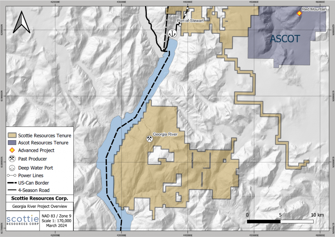
The 17,625-hectare high-grade gold Georgia Project, centered on the past-producing Georgia River Mine, is located on tidewater 16 kilometres south of the town of Stewart, BC, in the prolific Golden Triangle. The Georgia River Mine, which last operated in 1939 with a head grade of 22.6 g/t gold, contains 1.2 kilometres of underground access on three levels. The project was explored from the 1970s by several companies with the intent of restarting the mine, but this historic work focused almost exclusively on the area hosting the existing mine workings, which supports the presence of a much larger hydrothermal system. Only a small part of this hydrothermal system would have been explored by the past-producing mine or drill tested.
Project Highlights:
-
17,625 ha of claims surrounding the past producing Georgia River mine
-
Ideal Location: Situated on the Portland Canal, 16 km from Stewart with access to a deep-water port in ice free tidewater
-
High grade Au-Ag past producer in footwall of a major deformation zone
-
Gram-plus gold values over 590 metres of projected surface trace and veins in the old mine confirm presence of gold in a potentially large Early Jurassic hydrothermal system
-
3,600 m in 24 diamond drill holes completed in 2020 drill program at Georgia extending mineralization from the historic high-grade gold mine along strike and at depth
-
2,750 m of historic diamond drill core recovered, logged and assayed
Highlights from the 2021 drill program include:
- GE21-31 – 9.56 g/t gold and 22.1 g/t silver over 9.30 metres (82.05 to 91.35 metres) INCLUDING 16.1 g/t gold and 36.4 g/t silver over 5.00 metres (83.00 to 88.00 metres)
Highlights from the 2020 drill program include:
- GE20022 – 62.5 g/t gold and 36.6 g/t silver over 2.24 metres (60.26 to 62.50 metres)
- GE20023 – 69.1 g/t gold and 35.5 g/t silver over 4.14 metres (66.3 to 70.44 metres)
Historic drill intercepts at Georgia include:
- 178.4 g/t gold and 171 g/t silver over 0.49 metres (110.79 to 111.28 metres)
- 119.2 g/t gold and 66.4 g/t silver over 1.4 metres (72.71 to 74.09 metres) including 342.5 g/t gold and 190.6 g/t silver over 0.3 metres (73.48 to 73.78 metres)
- 140.8 g/t gold and 213.5 g/t silver over 0.6 metres (33.93 to 34.54 metres)
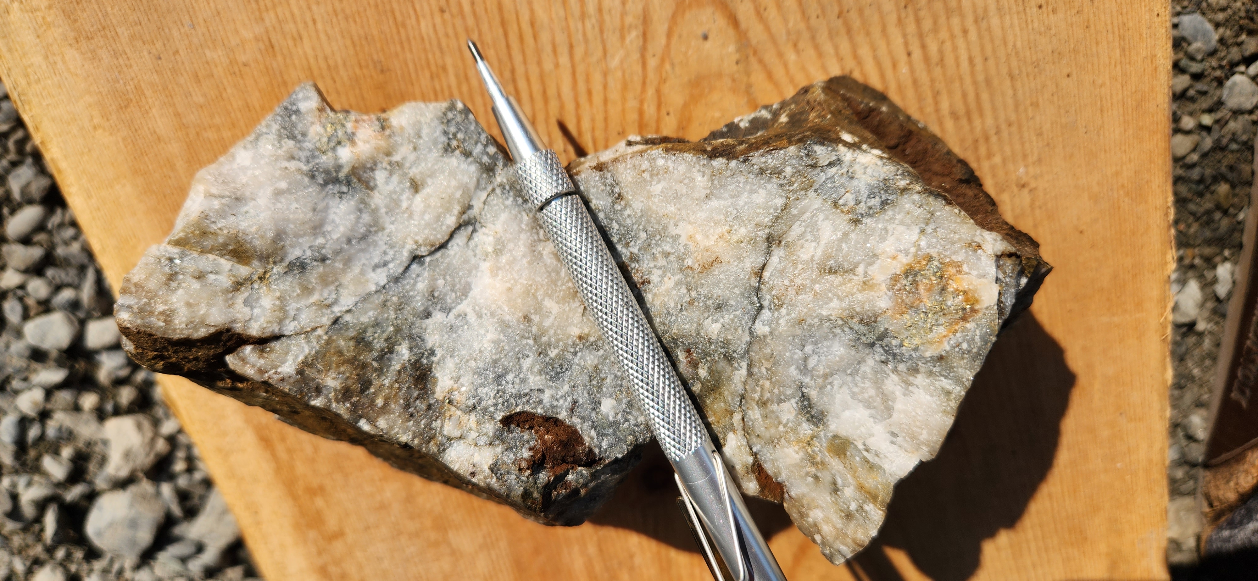
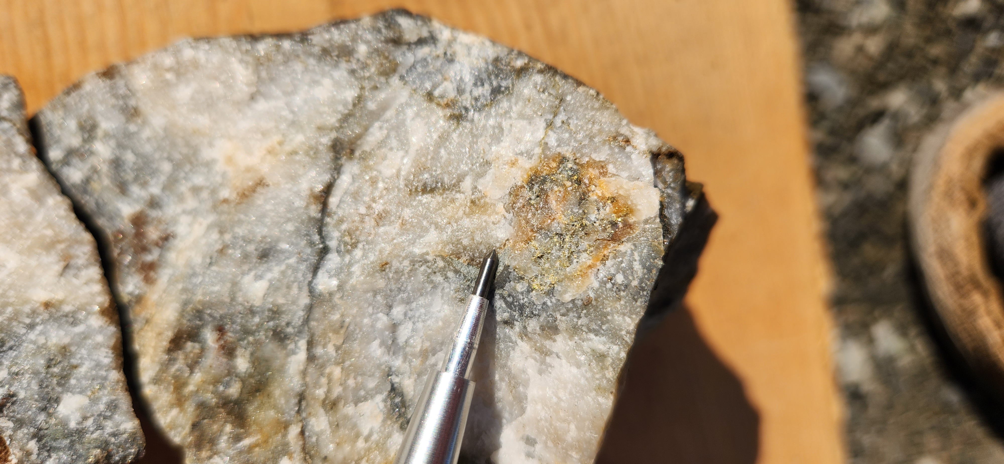
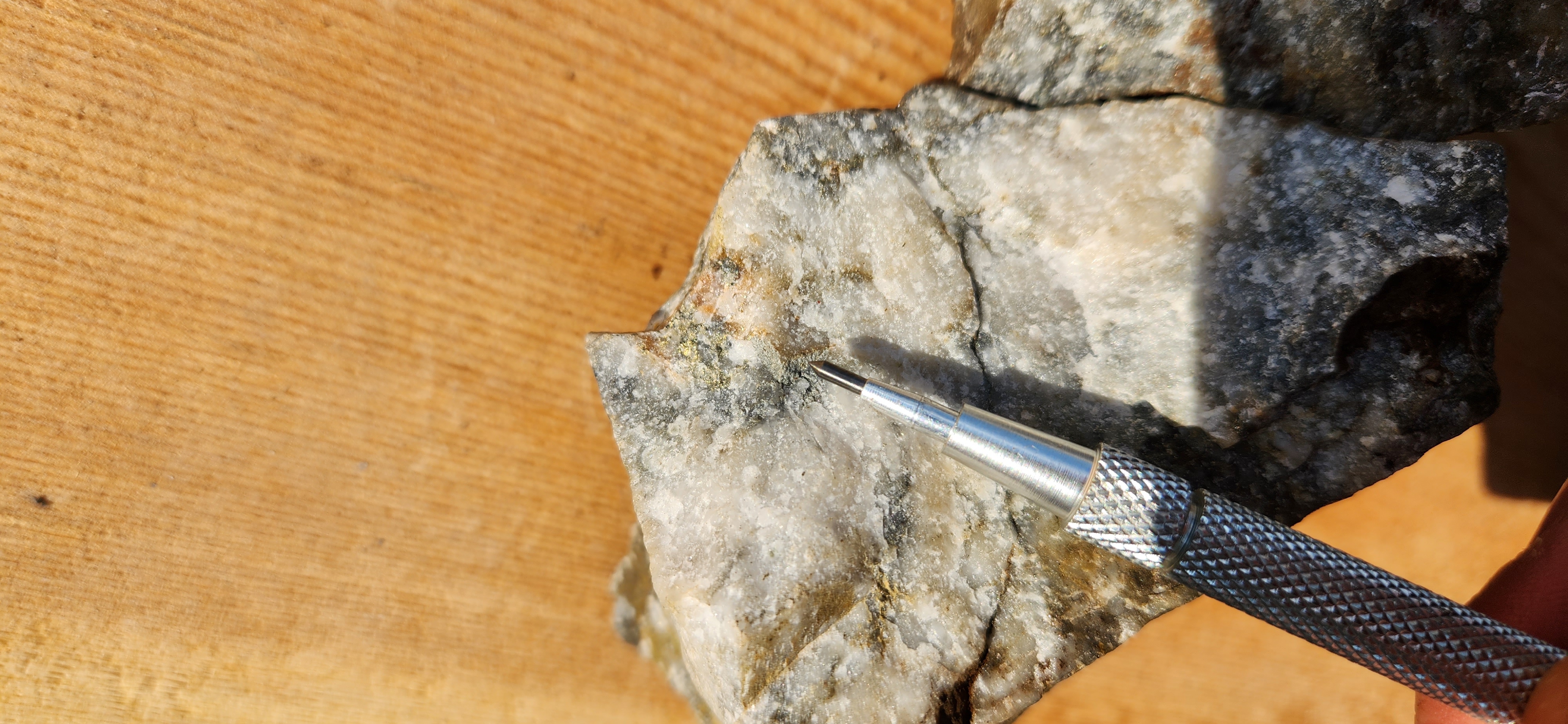
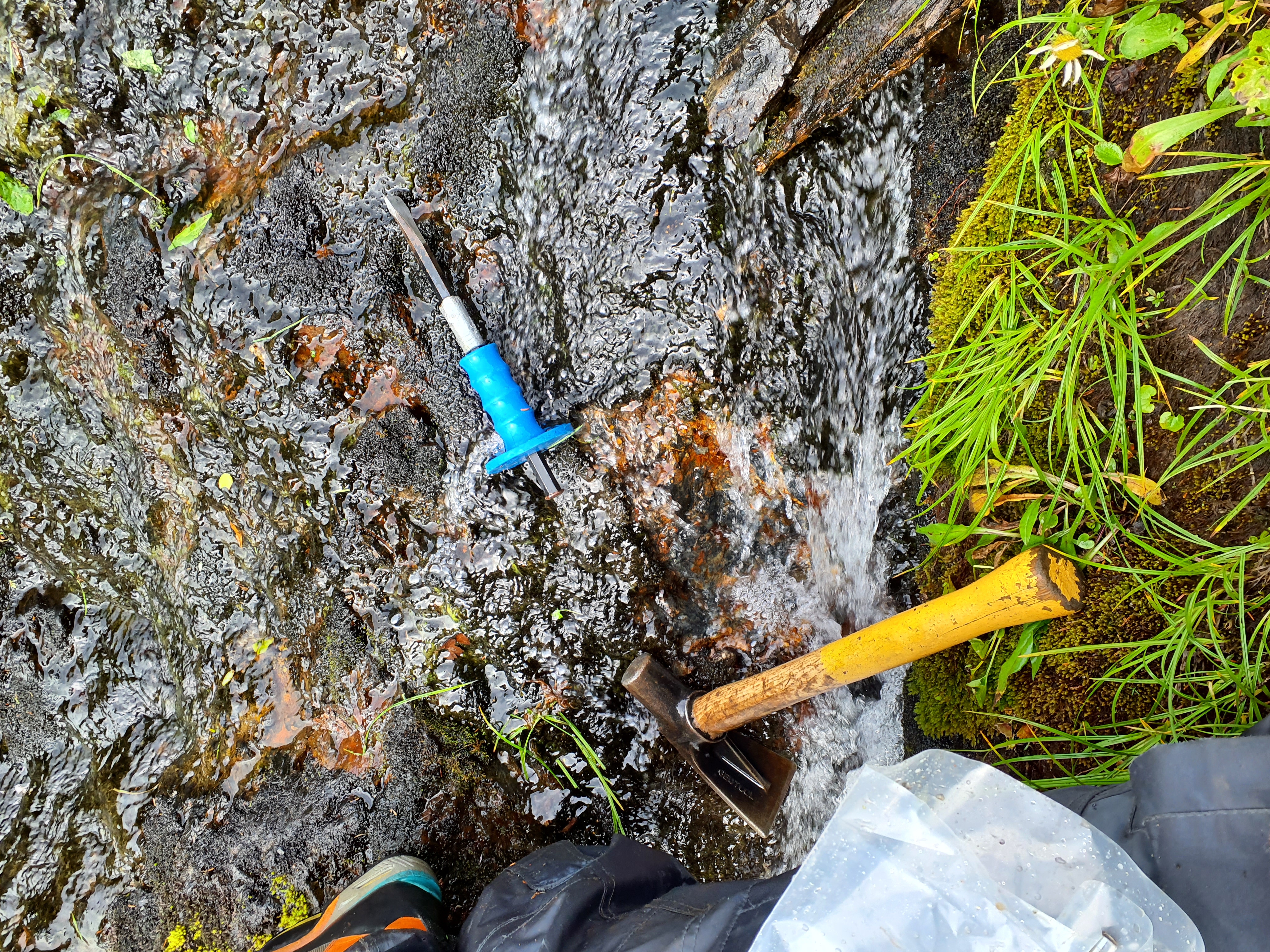
During the 2023 field season, prospecting, rock sampling, soil sampling and mapping were completed on the Georgia River Project. A total of 107 rock samples and 132 soil samples were collected.
The 2023 exploration program was successful in the discovery of a new high-grade vein structure that had never previously been sampled. Initial sampling from the vein yielded 165 g/t Au and 42 g/t Ag, with abundant visible gold. Follow up work along strike on this structure included samples that yielded 7.62 g/t Au, 1.26 g/t Au, and 1.2 g/t Au. This vein has similar geological characteristics and orientation as those previously mined at the Georgia River Mine, located 3.5 kilometres along strike from this new discovery.
Work in 2024 will be focused on detailed mapping, prospecting and sampling between this new showing and the historic Georgia River Mine, to determine if the mineralization is continuous between the
two showings. Work will be focussed on identifying key large-scale structures along with assessing lithological controls on mineralization.
The most recent documented, unclassified historic resource estimate for the SW Vein of the Georgia River Mine was completed in 1990 (BC Assessment Report 19,983) and estimated 276,403 tonnes of 27.6 g/t gold and 20.9 g/t silver. The estimate was based on 50 drill holes and considers a minimum mining width of 1.22 metres. The SW Vein historical estimate does not comply with CIM Definition Standards on Mineral Resources and Mineral Reserves as required by NI 43-101 and has no comparable resource classification. A qualified person has not done sufficient work to classify the historical estimate as a current mineral resource and the Company is not treating this historical resource as a current resource.