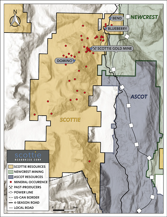
The Scottie Gold Mine Project is located 32 km north of Stewart, BC, and is situated 20 km north the Premier Gold Mine, 27 km south of Brucejack Mine, and 15 km east of the past-producing Granduc Mine. The Project includes the past-producing Scottie Gold Mine that operated from 1981 to 1985, and produced 95,426 oz gold at an average grade of 16.2 g/t, as well as other key targets, including Blueberry, Domino, and the Bend Vein.
The Scottie Gold Mine Project consists of 20 mineral claims and 14 Crown granted claims for a total area of 8,534 ha. Given the size and location of the Project within the Stewart Mining Camp, the area is relatively under explored. There are over thirty gold and/or silver bearing mineralized zones within the project area and prior to the 2021 field season, only seven have been drill tested.
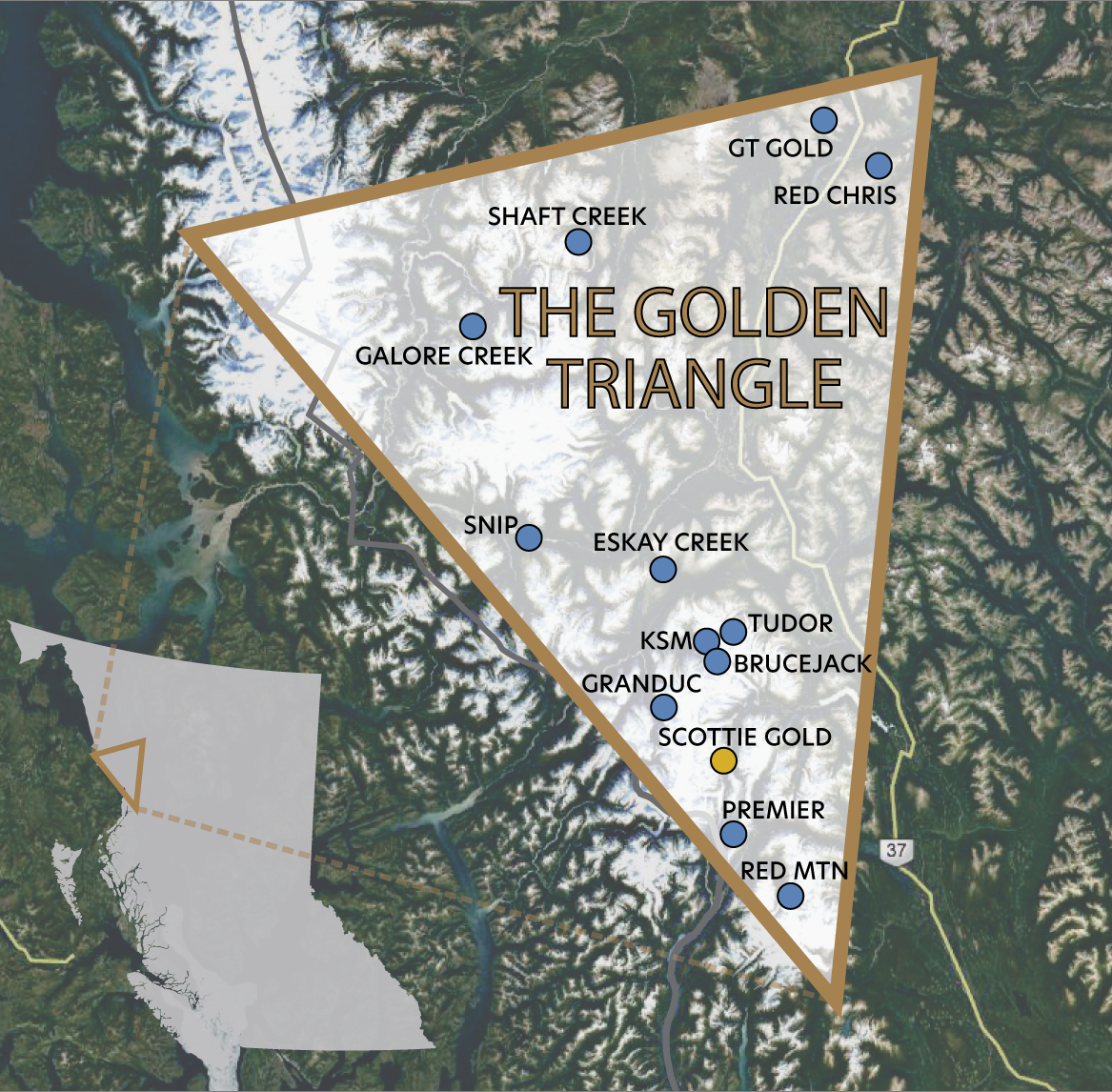
“One of the most important mineral trends of northwestern British Columbia extends from near the town of Stewart north to the Treaty Glacier, in the western part of the Stikine arc terrane. Major deposits along this trend include Kerr-Sulphurets-Mitchell (KSM), Brucejack, Silbak-Premier, Big Missouri, Scottie Gold and Red Mountain.”
(Nelson & Kyba, 2014)
Figure 1: Claims Map of the Scottie Gold Mine Project
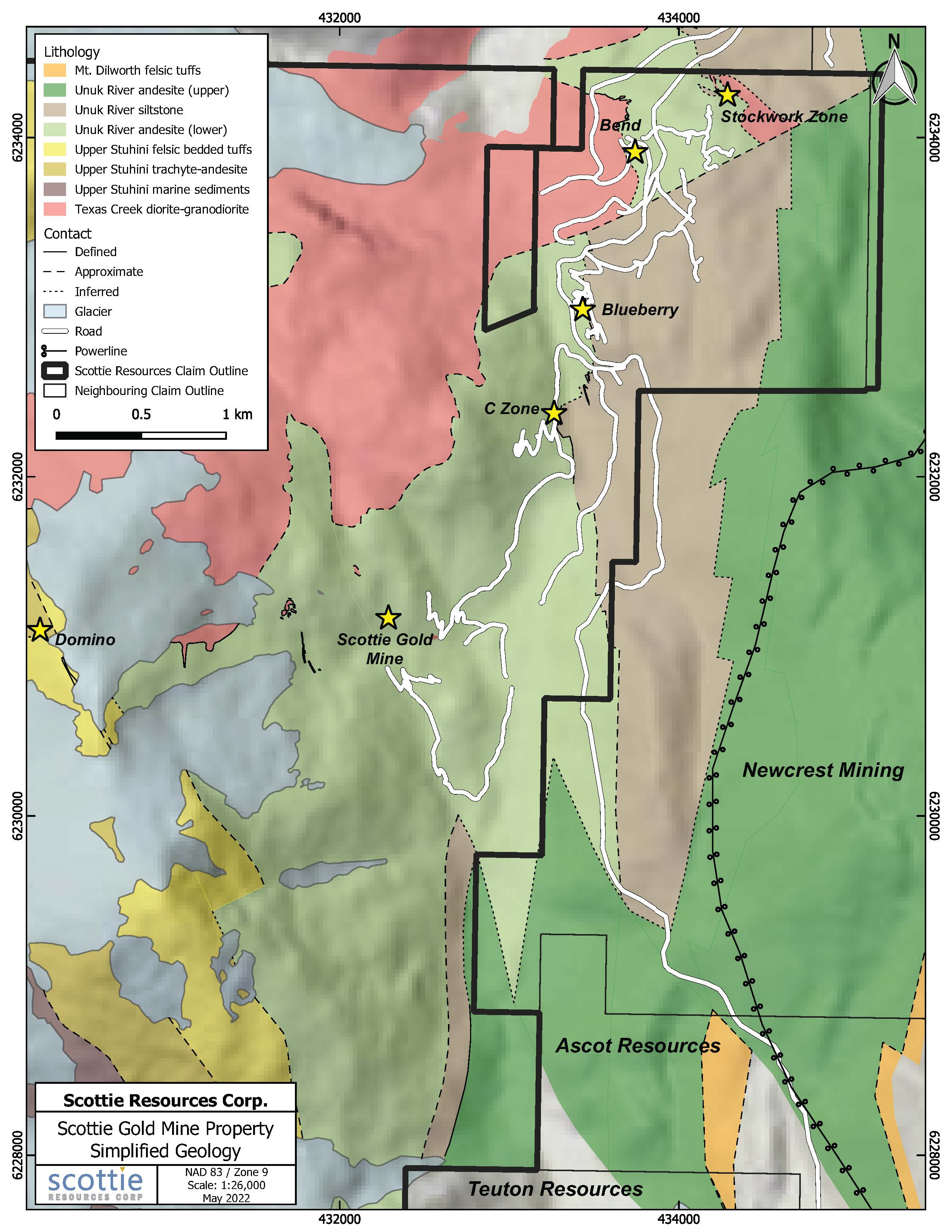
This strategic land package is in a favourable geologic position, hosting late Triassic Stuhini Group volcanic and sedimentary units to early Jurassic Hazelton Group volcanic and associated volcano-sedimentary units, as well as several early Jurassic stocks of the Texas Creek plutonic suite. The geological setting of the Scottie Gold Mine Project is similar to several significant deposits in the Golden Triangle.
A three-dimensional model of the historic Scottie Gold Mine deposit
Figure 2: Plan view map of Blueberry Zone with select 2022-2023 drilling
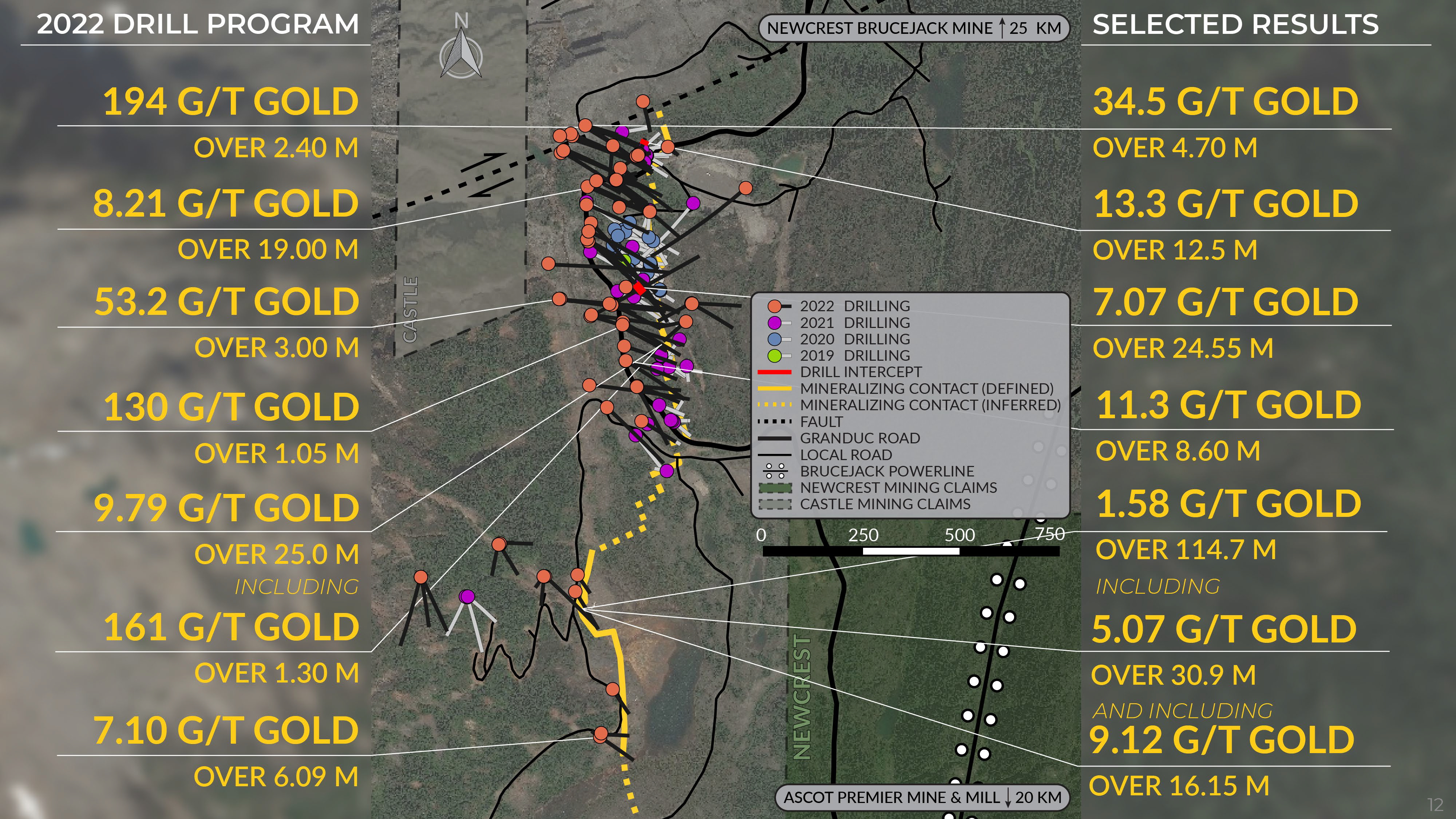
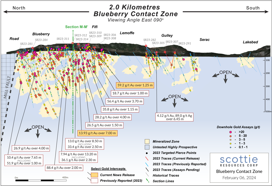
Figure 5: Long section view of the Blueberry Contact Zone ( Viewing angle East 90 degrees) with notable intercepts from 2019-2023.
Project Highlights:
- Past gold producer with an active mine permit
- The property is road accessible from the Granduc Road, and is 1 km west from the Brucejack Transmission Line
- Existing underground 200 tonne/day mill
- Underground infrastructure includes: 6 portals, shafts, rail system, and 7 km of drifts
- The deposit remains open along strike and at depth, and has potential for multiple parallel mineralized structures
- Limited exploration drilling on the property - at surface numerous high-grade mineralized veins have been identified but never drilled
- Excellent potential to significantly expand resources and reserves
This summary of potential may contain forward–looking statements. Forward-looking statements address future events and conditions and therefore involve inherent risks and uncertainties. Actual results may differ materially from those currently anticipated in such statements. The reader is cautioned that the above results reserve estimates have not been confirmed by the Company. These are being used for reference purposes and should not be relied upon.
Nelson, J., and Kyba, J., 2014. Structural and stratigraphic control of porphyry and related mineralization in the Treaty Glacier – KSM – Brucejack – Stewart trend of western Stikinia. In: Geological Fieldwork 2013, British Columbia Ministry of Energy and Mines, British Columbia Geological Survey Paper 2014-1, pp. 111-140.